Maps

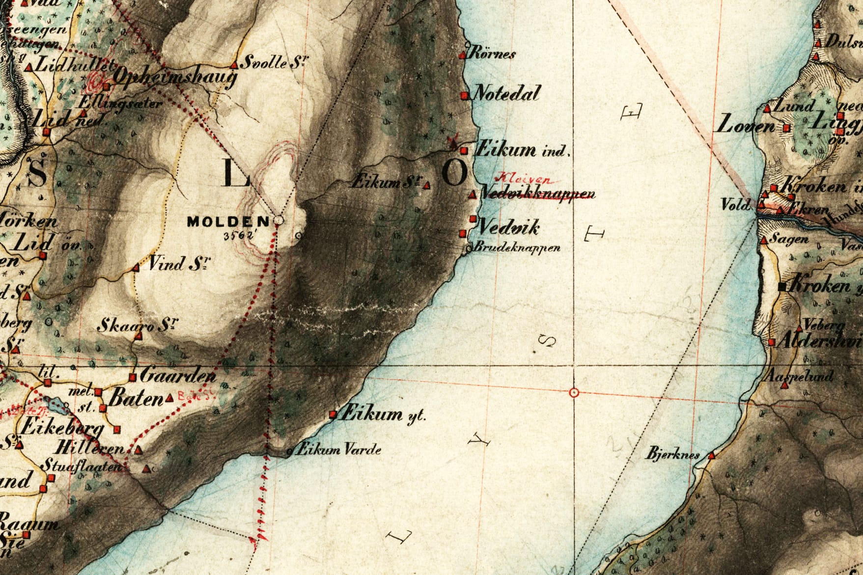
An old map from 1866.
Ytre Eikjo has here the old name Eikum Ytre, and you can see it in the center-lower part of the map.
Eikjastrondi extends from Ytre Eikjo to Notedal in the upper-right.
In the center-left to lower-left, you can see Skaaro, Hilleren, and Stuaflaaten that some time in history has been shieling (seter) under Ytre Eikjo.
Norwegian Mapping Authority/Public domain
⁴.
Interactive map and aerial photo
Aerial overview of Ytre Eikjo.
Zoom in for more details.
Our cabin is the one with a black roof in the lower-left, under the open green area.
Norwegian Mapping Authority.
Ytre Eikjo is located almost at the inner end of the longest fjord in Norway.
Norwegian Mapping Authority.